Notice

I am working on the template of this blog today in order to chase down some problems that have developed with my template and widgets.

Macon County Commissioners

Coverage of the meetings of the Macon County Board of County Commissioners.

Franklin Town Board of Aldermen

Coverage of the meetings of the Franklin Town Board of Aldermen.

Macon County School Board

Coverage of the meetings of the Macon County School Board.

Photoblog

Photos from my photoblog.

nullspace for future use

nullspace for future use

About

Showing posts with label Officer Involved Shooting. Show all posts

Thursday, August 2, 2018

Daily Weather Briefing for Thursday, August 2, 2018
Momphard Cleared in Knibbs Shooting


MOMPHARD CLEARED IN KNIBBS SHOOTING

District Attorney Greg Newman cleared Deputy Sheriff Momphard of any criminal prosecution in the shooting death of Scott Knibbs in his home on April 30, 2018. A press release follows: (spelling and grammar retained)

MACON COUNTY DEPUTY CLEARED IN SHOOTING INCIDENT

Macon County Deputy Sheriff Anthony Wade Momphard, Jr. has been cleared by District Attorney Greg Newman of any criminal prosecution in the shooting death of Michael Scott Knibbs on May 1, 2018. “I accepted this case from the District Attorney for Macon County, Ashley Welch, when she advised me that she wanted to avoid any potential conflict of interest or an appearance of impropriety. I studied the evidence provided by the North Carolina State Bureau of Investigation, consulted with the SBI agents involved, as well as senior members of my investigation staff and lawyers, and have concluded that Deputy Momphard was justified in his use of force that resulted in the death of Mr. Knibbs, “ said Mr. Newman. “North Carolina law permits all law enforcement officers in our state to use their firearms to defend themselves and this deputy had the barrel of a shotgun pointed at his head at close range. He reacted in the only way that he could given the circumstances,” added Newman.

Deputy Momphard was sent by the sheriff’s office to Pheasant Drive in Franklin just minutes before midnight on a report of a dispute between neighbors. Records show that he arrived at 164 Pheasant Drive at 11:55 pm. He had to stop his marked cruiser due to an obstruction in the roadway. The deputy described the obstruction as two boards stacked on top of one another. He then saw several boards in the roadway that appeared to be carefully measured between each other. Momphard approached the front of the Knibbs’ residence at 164 Pheasant Drive and announced his presence as “Macon County Sheriff’s Office.” When he received no response, he walked to the back of the home and knocked loudly on the back door and again announced that he was with the sheriff’s office. Again, there was no response, and the deputy saw the next door home up the hill and approached it on foot. The actual caller to the sheriff’s office lived at that home, which is 224 Pheasant Drive. One of the residents, Shelton Freeman, met the deputy and explained that the call came from him because one of his friends could not drive on the roadway due to the boards placed there by Scott Knibbs. Mr. Freeman and his two roomates, T.J. Brown and Tiffany Austin, had only lived at the residence for less than a month.

According to Mr. Freeman, his two roomates and him were having a cookout that evening. Most of his friends had arrived earlier in the evening, but one of his friends came at around 11 pm and mistakenly drove into Mr. Knibb’s driveway. Scott Knibbs came out of a shed and asked the person if he was there to buy pills. The person said he was looking for his friend’s home and Mr. Knibb’s became aggressive and told him to get off his property. Knibbs kicked this person’s car as he drove off. According to the interview of Knibbs’ wife, Mr. Knibbs told her that he shoved the young man back into his car.

At approximately 11:30 pm, one of the visitors at the cookout left to go home, only to return to 224 Pheasant to state that she could not leave due to several boards with nails placed in the roadway in front of Knibbs’ home. Mr. Freeman and at least two of his friends walked down the road to inspect the situation and observed at least four rows of double stacked boards placed in the road as speed bumps. There were nails visible in the boards, but they were not sticking straight up like a stop strip. The decision was made to call the Sheriff’s department instead of removing the boards. Mr. Freeman later told investigators that in the short time he had lived at Pheasant Drive, there had been some uncomfortable contacts with Mr. Knibbs. These included Knibbs telling the residents to shut their dogs up from barking or he would shut them up, showing up intoxicated at Freeman’s home and also making an obscene gesture to the person mowing the yard for Freeman.

After speaking with the deputy sheriff about the road obstruction, Deputy Momphard and Mr. Freeman walked towards the Knibbs’ residence. Mr. Freeman was going to remove the boards and the deputy attempted a second contact with the Knibbs. When approaching the front door, Deputy Momphard again announced himself as “Macon County Sheriff’s Office.” This was corroborated by both Mr. Freeman and by Knibbs’ wife, who told SBI agents that she heard the deputy identify himself.

As Deputy Momphard approached the door, he heard someone “rack” a round in a shotgun. Momphard immediately shouted for the person to put the weapon down. He shouted this instruction at least three times. This admonition was heard by everyone up the road at 224 Pheasant, as well as Ms. Knibbs inside residence. The deputy stepped to the side of the door and shined his flashlight into a window next to the door. He saw a man pointing a shotgun at his upper torso or head. The deputy backed away and began shooting through the window. He then entered the Knibbs’ home and saw Mr. Knibbs face down on the floor. Ms. Knibbs came into the room screaming and the Knibbs’ daughter came in screaming as well. The only light in the room at the time came from Momphard’s flashlight. He told the two women to stand back and to keep their hands where he could see them. He called for backup and EMS and then allowed Ms. Knibbs to approach and to check on her husband.

Other officers, including Macon County Sheriff Holland, arrived and medical personnel attended to Knibbs, who was pronounced dead at the scene. Momphard fired six shots from his service revolver. The shotgun possessed by Knibbs was loaded and taken by law enforcement as evidence. The medical examiner conducted an autopsy of Mr. Knibbs’ body at the Harris Regional Hospital and confirmed the cause of death to be two gunshot wounds. One wound was in the right chest and one through the upper right arm.

“Three things stand out to me in this case, “ stated Mr. Newman. “ One, we want people to call law enforcement in these situations to avoid confrontations with neighbors or anyone else. So I applaud Mr. Freeman for requesting the intervention of the sheriff’s department. Two, Deputy Momphard’s actions were justifiable in every aspect. His only option was to defend himself given that Mr. Knibbs racked his shotgun and pointed it at the deputy after repeated commands to drop the weapon. This incident took place in the middle of the night with little to no lighting. Third, Ms. Knibbs stated in her interview that she heard the deputy announce himself as her husband walked toward the door and racked his firearm.”

“This entire incident is a tragedy and the deputy certainly did not anticipate these events,” added Newman. “ In his interview with the SBI, the deputy said that he expected this call would be simple to address. He had responded to right of way disputes before and thought this occasion would be routine. He would speak to the participants and hopefully resolve the issue. The use of his firearm is not what he intended, but he handled the situation in the only way he could. These deputies are called into service in the middle of the night, usually alone, and are at great risk for their safety. Deputy Momphard has a wife and two children and he deserves to finish his shift and return home to his family. I appreciate the dedicated service to our communities of Deputy Momphard and all law enforcement officers, wherever they serve,” said Newman.

The District Attorney further added, “I have contacted the attorney for the Knibbs’ family and advised him of my decision. As always, I will make my file available for review to him and members of the Knibbs family if they so choose. I have recommended to Sheriff Holland that Deputy Momphard be returned to active duty whenever he feels it appropriate.

KNIBBS FAMILY ATTORNEY RESPONDS

“I would just say we are disappointed with the decision and I plan to meet as soon as possible with Mr Newman to obtain more information. At that point the family will decide the best course of action.”

Melrose cannot indicate at this point whether the family will be filing a civil suit because they have not reviewed the SBI report. The family, he added, has the right to pursue other remedies despite the lack of a criminal indictment.

The news (in both instances) was broken by Trappalachia, an internet News Outlet operated by Davin Eldridge, who is also a reporter for the Macon County News. DA Press Release: [LINK]

Macon Media was not notified by either District Attorneys Office of the press release.


Previous coverage of this incident can be found at the following links, in reverse chronological order:


May 8th: Rally in Support of Scott Knibbs  
http://thunderpigblog.blogspot.com/2018/05/rally-in-support-of-scott-knibbs-may-8.html

May 1st linkage to WYFF-TV Story that relays the family's side of the story (not mirrored on this website until now)
https://www.facebook.com/MaconMediaNews/posts/1718654301514033

May 1st Weather Briefing, Lead Story
http://thunderpigblog.blogspot.com/2018/05/wx20180501.html

Facebook Mirror
https://www.facebook.com/MaconMediaNews/posts/1718014978244632
----------------
April 30th Weather Briefing, Lead Story
http://thunderpigblog.blogspot.com/2018/04/wx20180430.html

Facebook Mirror 
https://www.facebook.com/MaconMediaNews/posts/1717036971675766

LOCAL WEATHER OUTLOOK

A broad area of low pressure will persist across the Tennessee Valley to our west through at least Friday. This low will transport deep moisture from the Gulf of Mexico and produce abundant cloud cover and continued rounds of precipitation, which will hold high temperatures below normal. A slow increase in temperatures and decrease in precipitation is expected over the weekend as high pressure builds back in.


WEATHER SPONSOR



Adams Products, a Division of Oldcastle is underwriting the daily weather briefing & public safety updates for the month.

Open 7:30 AM to 4:00 PM, M-F, located at 895 Hickory Knoll Road, Franklin, NC. Visit our Facebook page at:
https://www.facebook.com/Adams.Oldcastle.Franklin.NC/

All your masonry needs are available. Our phone number is 828.524.8545, the public is welcome, we’ll help you with your with your next project.

Weather Almanac for August 2nd (1872-2016)
Record weather events for this date in Macon County

Highest Temperature 94°F at the Coweeta Experimental Station in 1999
Lowest Temperature 45°F in Highlands in 1895
Greatest Rainfall 3.66 inches at the Coweeta Experimental Station in 1948

Record Weather Events for August (1872-2017)

Highest Temperature 99°F in Franklin on August 9, 1980
Lowest Temperature 40°F at the Coweeta Experimental Station on August 29, 1968
Greatest Rainfall 9.68 inches in Highlands on August 13, 1940


WEATHER FORECAST MAPS

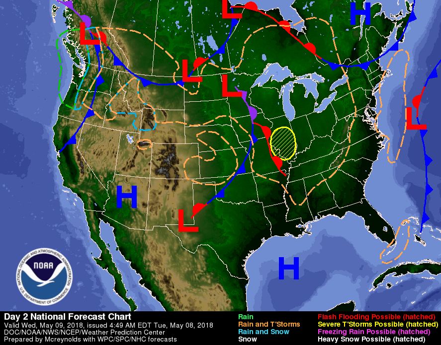
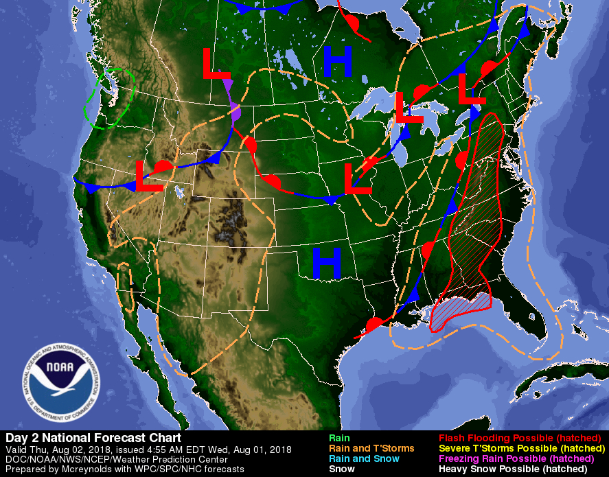
Forecast maps for 8 am, 2 pm, and 8 pm. 

[click on any image in this article to enlarge]
(These images replace the three-day forecast maps)


THREE DAY OUTLOOK


--------------------------------------

FRANKLIN AREA

TODAY

Showers, with thunderstorms also possible after 10am. Patchy fog before 1pm. High near 74. Light east wind. Chance of precipitation is 90%. New rainfall amounts between 1 and 2 inches possible.

TONIGHT

Showers and possibly a thunderstorm before 10pm, then showers likely. Patchy fog after 9pm. Low around 64. Light north northeast wind. Chance of precipitation is 80%. New precipitation amounts between three quarters and one inch possible.

FRIDAY

Showers likely. Mostly cloudy, with a high near 79. Light south wind. Chance of precipitation is 60%. New rainfall amounts between a quarter and half of an inch possible.

FRIDAY NIGHT

A chance of showers and thunderstorms. Mostly cloudy, with a low around 63. Calm wind. Chance of precipitation is 50%.

SATURDAY

A chance of showers, with thunderstorms also possible after 11am. Partly sunny, with a high near 82. Chance of precipitation is 50%.


SATURDAY NIGHT

A chance of showers and thunderstorms. Mostly cloudy, with a low around 64. Chance of precipitation is 50%.


--------------------------------------

OTTO AREA

TODAY

Showers, with thunderstorms also possible after 10am. Some of the storms could produce heavy rainfall. Patchy fog before 3pm. High near 72. Light east wind. Chance of precipitation is 90%. New rainfall amounts between 1 and 2 inches possible.

TONIGHT

Showers and possibly a thunderstorm before 10pm, then showers likely. Patchy fog after 8pm. Low around 63. Light east northeast wind. Chance of precipitation is 80%. New precipitation amounts between three quarters and one inch possible.

FRIDAY

Showers likely and possibly a thunderstorm before 1pm, then showers and thunderstorms likely, mainly between 1pm and 3pm. Mostly cloudy, with a high near 76. Calm wind becoming south around 5 mph in the afternoon. Chance of precipitation is 60%. New rainfall amounts between a quarter and half of an inch possible.

FRIDAY NIGHT

A chance of showers and thunderstorms. Mostly cloudy, with a low around 62. Calm wind. Chance of precipitation is 50%.

SATURDAY

A chance of showers, with thunderstorms also possible after 11am. Partly sunny, with a high near 80. Chance of precipitation is 50%.

SATURDAY NIGHT

A chance of showers and thunderstorms. Mostly cloudy, with a low around 64. Chance of precipitation is 50%.


--------------------------------------

HIGHLANDS AREA

TODAY

Showers, with thunderstorms also possible after 10am. Some of the storms could produce heavy rainfall. Patchy fog before 3pm. High near 67. Southwest wind 6 to 8 mph. Chance of precipitation is 90%. New rainfall amounts between 1 and 2 inches possible.

TONIGHT

Showers and possibly a thunderstorm. Some of the storms could produce heavy rainfall. Patchy fog after 9pm. Low around 60. South wind around 7 mph becoming west northwest after midnight. Chance of precipitation is 80%. New precipitation amounts between 1 and 2 inches possible.

FRIDAY

Showers likely. Mostly cloudy, with a high near 69. Southwest wind 3 to 5 mph. Chance of precipitation is 70%. New rainfall amounts between a quarter and half of an inch possible.

FRIDAY NIGHT

Showers and thunderstorms likely before 1am, then a chance of showers. Mostly cloudy, with a low around 60. Light south southwest wind. Chance of precipitation is 60%.

SATURDAY

Showers likely. Partly sunny, with a high near 72. Chance of precipitation is 60%.

SATURDAY NIGHT

Showers and thunderstorms likely before 2am, then a chance of showers. Mostly cloudy, with a low around 61. Chance of precipitation is 60%.


--------------------------------------

NANTAHALA AREA

TODAY

Showers, with thunderstorms also possible after 10am. Patchy fog before 2pm. High near 72. South wind 3 to 5 mph. Chance of precipitation is 90%. New rainfall amounts between three quarters and one inch possible.

TONIGHT

Showers and possibly a thunderstorm before 10pm, then showers likely. Patchy fog after 9pm. Low around 61. Light and variable wind. Chance of precipitation is 80%. New precipitation amounts between a half and three-quarters of an inch possible.

FRIDAY

Showers likely. Mostly cloudy, with a high near 73. South wind 3 to 5 mph. Chance of precipitation is 60%. New rainfall amounts between a quarter and half of an inch possible.

FRIDAY NIGHT

A chance of showers and thunderstorms. Mostly cloudy, with a low around 61. Light south southeast wind. Chance of precipitation is 50%.

SATURDAY

A chance of showers, with thunderstorms also possible after 11am. Partly sunny, with a high near 75. Chance of precipitation is 50%.

SATURDAY NIGHT

A chance of showers and thunderstorms. Mostly cloudy, with a low around 61. Chance of precipitation is 50%.

--------------------------------------


GOES-16 GeoColor - True Color daytime, multispectral IR
1:17 am to 3:12 am this morning


HAZARDS

Heavy rain is possible today and conditions will remain favorable for localized heavy rainfall each afternoon into Sunday. Meanwhile, the thunderstorms will be capable of dangerous cloud to ground lightning.

Macon County is under Flash Flood Watch until Friday morning. A copy of the watch is posted below for your convenience:

Flash Flood Watch

National Weather Service Greenville-Spartanburg SC
1027 PM EDT Wed Aug 1 2018

...THE THREAT OF HEAVY RAINFALL AND ASSOCIATED FLASH FLOODING ACROSS THE WESTERN CAROLINAS AND NORTHEAST GEORGIA WILL CONTINUE THROUGH FRIDAY MORNING...

.A low-pressure system stretching from the Midwest to the central coast of the Gulf of Mexico will transport deep moisture across the western Carolinas and northeast Georgia through the week. Several rounds of heavy rain showers and thunderstorms will result from this influx of moisture. As the ground moistens and stream levels rise, the threat of flash flooding will develop with any heavy downpours moving repeatedly over the same location.


...FLASH FLOOD WATCH REMAINS IN EFFECT THROUGH FRIDAY MORNING...

The Flash Flood Watch continues for Macon County through Friday morning

* Showers and thunderstorms producing periods of heavy rainfall will continue through at least Friday morning. Expect widespread storm total rainfall amounts of 3 to 5 inches across the mountains and immediately adjacent foothills, with localized amounts up to 6 inches possible. While rainfall will be less over the Piedmont closer to the Charlotte Metro area, 2 to 3 inches of rain is likely with locally 4 inches possible. Of course, realize that just one hour of repeated thunderstorms over a location could quickly produce 2 to 3-inch rainfall totals. As soils saturate, flash flooding will become increasingly likely across the area.

* The heavy rainfall may produce flooding on area streams and creeks, and possibly on some main stem rivers by later in the week. Pay close attention to rainfall totals in the mountains this week since locations with steep slopes will see an increase in the potential for isolated landslides once rainfall exceeds five inches.

PRECAUTIONARY/PREPAREDNESS ACTIONS...

A Flash Flood Watch means that conditions may develop that lead to flash flooding. Flash flooding is a very dangerous situation.

You should monitor later forecasts and be prepared to take action should Flash Flood Warnings be issued.


Macon Media maintains a Severe Weather Preparedness Page at http://thunderpigblog.blogspot.com/p/breaking-news-hub.html for those who are interested.

As always, you can check to see what advisories, watches, and warnings are in effect for Macon County by visiting http://is.gd/MACONWARN


GOES 16 - Band 15 - 12.3 µm - Dirty Longwave Window - IR (Precipitation)
3:17 am this morning

TROPICAL OUTLOOK
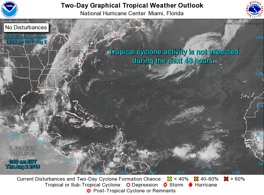


Tropical Weather Outlook
NWS National Hurricane Center Miami FL
200 AM EDT Thur Aug 2 2018

For the North Atlantic...Caribbean Sea and the Gulf of Mexico:

Tropical cyclone formation is not expected during the next 5 days.


MACON CALENDAR

If you have an event you wish to be added to this calendar, please send the information, along with a flyer in pdf format or a high-quality photo, to editor@maconmedia.com. If you want text published, please include a paragraph with your photo, flyer or graphics. Please include date(s) and time(s).
There is no charge for civic, educational or nonprofit groups, except for groups or events that receive funding from the TDA, TDC, and EDC, where full rates apply.

Organizers of political events must make themselves available for a video interview at least 7 days before a political event they wish Macon Media to promote. Two weeks is the preferred time frame to maximize awareness.


Suminski Family Books Summer Film Fest for Families

All ticket sales sold by FROG volunteers benefit:

FRIENDS OF THE GREENWAY, INC.

Location: Smoky Mountain Center for the Performing Arts
Start time for each movie: 7:00 PM
Save When You Pre-Buy Your Tickets!

Single Ticket $5 for each movie (pre & at the door)
Season Pass $15 1 ticket to each movie Family of 4 Season Passes $50 4 tickets to each movie

Movies and Dates:

Paddington 2 on July 12, 2018
Hidden Figures on July 19, 2018
Peter Rabbit on August 19, 2018
Wonder on August 26, 2018 (benefits Friends of the Greenway)

Purchase at FROG Quarters, 573 E. Main (next to new bridge) Hours: Wed-Fri, 9 AM-2 PM

There are 3 other non-profits involved: Folk Heritage Association of Macon County NC, Grandpa’s Woodshed Project, Women’s History Trail, and Read2Me. The FROG-specific specific movie is Wonder, but our members can pre-sell tickets to all movies.

Franklin Health & Fitness 30th Anniversary Celebration [LINK]
http://thunderpigblog.blogspot.com/2018/07/franklin-health-fitness-announces-their.html

Uptown Gallery classes
(These are on-going classes – repeat weekly)

Free classes and open studio times are being offered at The Uptown Gallery in Franklin. Join others at a painting open studio session every Tuesday from 6:30 pm – 9:00 pm or on Thursday from 11:00 am – 3:00 pm.
Bring your own materials and join an on-going drawing course led by gallery artists on Fridays, from 11am – 2 pm. For information on days open, hours and additional art classes and workshops, contact the gallery on 30 East Main Street at (828) 349 – 4607.

National Alliance on Mental Illness
Appalachian South


Meets each Thursday at 7pm
The First Methodist Church Outreach Center
at the intersection of Harrison Ave. and West Main Street
(directly across from Lazy Hiker Brewery)

Come join our weekly support group for anyone suffering from mental illness and their family or friends. This includes Depression, Bipolar,8chizophrenia, PTSD, Substance Abuse, Etc.

Here you will find:
— others living with mental health challenges YOU ARE NOT ALONE
- learn coping skills and ?find hope in shared experience
- help learning how to break down stigma and guilt surrounding mental health
- how to live life with the expectation of a better a better future

Kay (706)970-9987 Denise (828)347-5000)

SYRINGE EXCHANGE PROGRAM

On January 1, 2017, the Syringe Exchange Program of Franklin began operating a comprehensive harm reduction program to address the opioid epidemic that is impacting western NC. Opioid overdose reversal kits including naloxone are available free of charge. If you have any questions about our services or if you know someone interested in volunteering, please contact Stephanie Almeida at 828-475-1920.



Sun and Moon

Sun

Begin civil twilight 6:16 a.m.
Sunrise 6:43 a.m.
Sun transit 1:40 p.m.
Sunset 8:36 p.m.
End civil twilight 9:03 p.m.


Moon

Moonrise 11:33 p.m. last night
Moon transit 5:41 a.m.
Moonset 11:55 a.m.


Phase of the Moon on August 2, 2018: Waning Gibbous with 71% of the Moon's visible disk illuminated.
Closest Primary Moon Phase: Last Quarter on August 4, 2018 at 2:18 p.m. (local daylight time)


Sky Guides for this week


Sky and Telescope Magazine 
Astronomy Magazine


There will be three solar and two lunar eclipses in 2018. [LINK]

Heavens Above has an Android App that will assist you in observing the sky and even has a satellite tracker that will let you know when the International Space Station and dozens of other satellites are overhead. [LINK]

Stellarium is also an app that will assist you in observing the sky. It is available in both Android [LINK] and iOS versions. [LINK]

CROWDFUNDING OR DAY SPONSORSHIP OPPORTUNITIES


If you receive value from what Macon Media provides to the community, please consider becoming a supporter and contribute at least a dollar a month.


Become a Patron!

If you have a business or event you are interested in sponsorship opportunities or underwriting coverage, send an email to editor@MaconMedia.com for more information. Serious inquiries only. Macon Media rewards early sponsors/underwriters with lifetime guaranteed low rates while newer sponsors/underwriters pay higher rates based on the date they first support Macon Media.

Thank You to the people who have been sending in donations and those businesses who are underwriting coverage of news and events. You have kept Macon Media online.


Published at 3:40 am on August 2, 2018

#WNCscan #MaconWx #MaconSafety


Data and information sources: Sources (except where otherwise credited): heavens-above.com, Ian Webster's Github, National Centers for Environmental Prediction, The National Weather Service, National Oceanic Atmospheric Administration, National Hurricane Center, Penn State University Electronic Wall Map, The State Climate Office of North Carolina, Storm Prediction Center, U.S. Naval Observatory, University of Utah Department of Atmospheric Sciences, and the Weather Prediction Center.

Tuesday, July 3, 2018

Daily Weather Briefing for Tuesday, July 3, 2018


LOCAL NEWS

Press Release from District Attorney Ashley Welch

STATE OF NORTH CAROLINA
General Court of Justice
Thirtieth Prosecutorial District

ASHLEY H. WELCH DISTRICT ATTORNEYS OFFICE
District Attorney

July 2. 2018

Press Release

Two weeks ago District Attorney Ashley Weich received the North Carolina State Bureau of Investigation report regarding the officer involved shooting in Macon County in April of 2018 that resulted in the death of Mr. Scott Knibbs. Prior to receiving the report. District Attorney Welch met with the Knibbs family along with their counsel to liven to their concerns.

After much consideration, District Attorney Ashley Welch decided today after having the opportunity to review the SBl case file to request another District Attorney to review this case: "I have decided to request a neighboring District Attorney to review the investigation out of an abundance of caution and out of respect to all parties involved in this matter. District Attorney Greg Newman of District 29B has graciously agreed to manage any and all prosecutorial decisions in this case."

Franklin Town Council Meets

The Franklin Town Council met for their regular monthly meeting last night. Coverage of the event is on the blog. [LINK]

LOCAL OUTLOOK

Weak high pressure will persist across the area through the work week. Abundant moisture will also be in place until the end of the week and result in afternoon and evening thunderstorms. High temperatures will run around normal through the week with seasonally high levels of humidity which will hold low temperatures a little above normal.

WEATHER SPONSOR


Adams Products, a Division of Oldcastle is underwriting the daily weather briefing & public safety updates for the month.

Open 7:30 AM to 4:00 PM, M-F, located at 895 Hickory Knoll Road, Franklin, NC. Visit our Facebook page at:
https://www.facebook.com/Adams.Oldcastle.Franklin.NC/

All your masonry needs are available. Our phone number is 828.524.8545, the public is welcome, we’ll help you with your with your next project.

Weather Almanac for July 3rd (1872-2016)
Record weather events for this date in Macon County

Highest Temperature 96°F in Franklin in 2012
Lowest Temperature 42°F in Highlands in 1918
Greatest Rainfall 2.79 inches at the Coweeta Experimental Station in 2013

Record Weather Events for July (1872-2017)

Highest Temperature 101°F in Franklin on July 29, 1952
Lowest Temperature 34°F in Highlands on July 2, 1911
Greatest Rainfall 21.15 inches in Highlands on July 29, 1879


THREE DAY OUTLOOK


--------------------------------------

FRANKLIN AREA

TODAY

A slight chance of showers, then a chance of showers and thunderstorms after 11am. Areas of fog before 9am. Otherwise, cloudy, then gradually becoming mostly sunny, with a high near 89. Light southeast wind. Chance of precipitation is 30%. New rainfall amounts of less than a tenth of an inch, except higher amounts possible in thunderstorms.

TONIGHT

A chance of showers and thunderstorms before 5am, then a slight chance of showers. Patchy fog after 5am. Otherwise, partly cloudy, with a low around 66. Calm wind. Chance of precipitation is 30%. New rainfall amounts of less than a tenth of an inch, except higher amounts possible in thunderstorms.

INDEPENDENCE DAY

A 20 percent chance of showers and thunderstorms after 10am. Mostly sunny, with a high near 86. Calm wind becoming east around 6 mph in the afternoon.

WEDNESDAY NIGHT

A 30 percent chance of showers and thunderstorms. Mostly cloudy, with a low around 66. Light east wind.

THURSDAY

A 40 percent chance of showers and thunderstorms. Partly sunny, with a high near 84.

THURSDAY NIGHT

A chance of showers and thunderstorms. Mostly cloudy, with a low around 65. Chance of precipitation is 40%.


--------------------------------------

OTTO AREA

TODAY

A slight chance of showers, then a chance of showers and thunderstorms after 11am. Areas of fog before 9am. Otherwise, cloudy, then gradually becoming mostly sunny, with a high near 87. Calm wind becoming southeast around 5 mph in the afternoon. Chance of precipitation is 30%. New rainfall amounts of less than a tenth of an inch, except higher amounts possible in thunderstorms.

TONIGHT

A 30 percent chance of showers and thunderstorms, mainly before 9pm. Patchy fog after 5am. Otherwise, partly cloudy, with a low around 66. Calm wind. New rainfall amounts of less than a tenth of an inch, except higher amounts possible in thunderstorms.

INDEPENDENCE DAY

A 30 percent chance of showers and thunderstorms, mainly after 1pm. Mostly sunny, with a high near 83. East northeast wind 3 to 7 mph. New rainfall amounts of less than a tenth of an inch, except higher amounts possible in thunderstorms.

WEDNESDAY NIGHT

A 40 percent chance of showers and thunderstorms. Mostly cloudy, with a low around 66. East northeast wind 3 to 5 mph.

THURSDAY

A 40 percent chance of showers and thunderstorms. Partly sunny, with a high near 82.

THURSDAY NIGHT

A chance of showers and thunderstorms. Mostly cloudy, with a low around 65. Chance of precipitation is 40%.


--------------------------------------

HIGHLANDS AREA

TODAY

A slight chance of showers, then a chance of showers and thunderstorms after 11am. Patchy fog before 9am. Otherwise, mostly sunny, with a high near 81. Calm wind becoming southeast 5 to 7 mph in the afternoon. Chance of precipitation is 30%. New rainfall amounts of less than a tenth of an inch, except higher amounts possible in thunderstorms.

TONIGHT

A 30 percent chance of showers and thunderstorms, mainly before 11pm. Partly cloudy, with a low around 64. East wind 5 to 8 mph. New rainfall amounts of less than a tenth of an inch, except higher amounts possible in thunderstorms.

INDEPENDENCE DAY

A 30 percent chance of showers and thunderstorms, mainly after noon. Patchy fog before 8am. Otherwise, mostly sunny, with a high near 76. East wind 6 to 9 mph. New rainfall amounts of less than a tenth of an inch, except higher amounts possible in thunderstorms.

WEDNESDAY NIGHT

A 40 percent chance of showers and thunderstorms. Mostly cloudy, with a low around 62. East wind 5 to 8 mph.

THURSDAY

A 50 percent chance of showers and thunderstorms. Partly sunny, with a high near 75.

THURSDAY NIGHT

A chance of showers and thunderstorms. Mostly cloudy, with a low around 62. Chance of precipitation is 50%.


--------------------------------------

NANTAHALA AREA

TODAY

A slight chance of showers, then a chance of showers and thunderstorms after noon. Patchy fog before 9am. Otherwise, partly sunny, with a high near 84. Calm wind becoming southeast around 5 mph in the afternoon. Chance of precipitation is 30%. New rainfall amounts of less than a tenth of an inch, except higher amounts possible in thunderstorms.

TONIGHT

A 30 percent chance of showers and thunderstorms, mainly before 7pm. Patchy fog between 1am and 2am. Otherwise, partly cloudy, with a low around 65. Calm wind becoming east around 5 mph after midnight. New rainfall amounts of less than a tenth of an inch, except higher amounts possible in thunderstorms.

INDEPENDENCE DAY

A 30 percent chance of showers and thunderstorms, mainly after 2pm. Patchy fog before 7am. Otherwise, mostly sunny, with a high near 80. East wind 5 to 7 mph. New rainfall amounts of less than a tenth of an inch, except higher amounts possible in thunderstorms.

WEDNESDAY NIGHT

A 40 percent chance of showers and thunderstorms. Mostly cloudy, with a low around 63. East wind around 6 mph.

TGURSDAY

A 40 percent chance of showers and thunderstorms. Mostly sunny, with a high near 78.

THURSDAY NIGHT

A chance of showers and thunderstorms. Partly cloudy, with a low around 63. Chance of precipitation is 50%.

--------------------------------------


GOES-16 GeoColor - True Color daytime, multispectral IR
12:17 am to 3:12 am this morning


HAZARDS

Hazardous Weather is not expected today.

There is a chance of thunderstorms today through Thursday. Isolated strong storms are possible with strong gusty winds, lightning, and heavy rains the main concerns, but once again, only isolated.

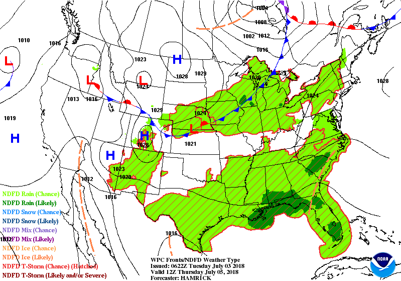
A frontal boundary will move into the region Friday through Sunday producing more widespread thunderstorms each day. Some of these storms may become strong to severe. Damaging winds, hail up to quarter size, frequent lightning, and heavy rainfall are possible.

Macon Media maintains a Severe Weather Preparedness Page at http://thunderpigblog.blogspot.com/p/breaking-news-hub.html for those who are interested.

As always, you can check to see what advisories, watches, and warnings are in effect for Macon County by visiting http://is.gd/MACONWARN


GOES 16 - Band 15 - 12.3 µm - Dirty Longwave Window - IR (Precipitation)
3:17 am this morning

TROPICAL OUTLOOK


Tropical Weather Outlook
NWS National Hurricane Center Miami FL
200 AM EDT Tue Jul 3 2018

For the North Atlantic...Caribbean Sea and the Gulf of Mexico:

1. Disorganized showers and thunderstorms extending from the north-central Gulf of Mexico northward are associated with a broad trough of low pressure. This disturbance is gradually moving inland over southeastern Louisiana and development is not anticipated.

* Formation chance through 48 hours...low...near 0 percent.
* Formation chance through 5 days...low...near 0 percent.

2. A non-tropical low pressure system is expected to form about midway between Bermuda and the southeastern United States by the end of the week. That system could gradually acquire some tropical characteristics over the weekend while it moves slowly northward and then northeastward away from the United States.

* Formation chance through 48 hours...low...near 0 percent.
* Formation chance through 5 days...low...20 percent.


MACON CALENDAR

If you have an event you wish to be added to this calendar, please send the information, along with a flyer in pdf format or a high-quality photo, to editor@maconmedia.com. If you want text published, please include a paragraph with your photo, flyer or graphics. Please include date(s) and time(s).
There is no charge for civic, educational or nonprofit groups, except for groups or events that receive funding from the TDA, TDC, and EDC, where full rates apply.

Organizers of political events must make themselves available for a video interview at least 7 days before a political event they wish Macon Media to promote. Two weeks is the preferred time frame to maximize awareness.


FRIENDS OF THE GREENWAY BUTTERFLY GARDEN RENEWAL CELEBRATION DAY

Friends of the Greenway is having a Butterfly Garden Renewal Celebration Day on Tuesday, July 10, 2018 from 9 AM to 11 AM. There will be a Ribbon Cutting at 9:30 AM to welcome the community to the renovated garden. Bringing back the eleven-year-old garden was funded in part with a grant from the Macon County Unrestricted Endowment Fund which is administered by the North Carolina Community Foundation. Find out about the butterflies that can be found in the area and the plants that maintain their lifecycle. Park behind the Shops at Riverwalk on Highlands Road. Follow the Greenway trail for a short distance--just past the Rotary Shelter. Rain date is Wednesday, July 11.

Suminski Family Books Summer Film Fest for Families

All ticket sales sold by FROG volunteers benefit:

FRIENDS OF THE GREENWAY, INC.

Location: Smoky Mountain Center for the Performing Arts
Start time for each movie: 7:00 PM
Save When You Pre-Buy Your Tickets!

Single Ticket $5 for each movie (pre & at the door)
Season Pass $15 1 ticket to each movie Family of 4 Season Passes $50 4 tickets to each movie

Movies and Dates:

Paddington 2 on July 12, 2018
Hidden Figures on July 19, 2018
Peter Rabbit on August 19, 2018
Wonder on August 26, 2018 (benefits Friends of the Greenway)

Purchase at FROG Quarters, 573 E. Main (next to new bridge) Hours: Wed-Fri, 9 AM-2 PM

There are 3 other non-profits involved: Folk Heritage Association of Macon County NC, Grandpa’s Woodshed Project, Women’s History Trail, and Read2Me. The FROG-specific specific movie is Wonder, but our members can pre-sell tickets to all movies.


Uptown Gallery classes
(These are on-going classes – repeat weekly)

Free classes and open studio times are being offered at The Uptown Gallery in Franklin. Join others at a painting open studio session every Tuesday from 6:30 pm – 9:00 pm or on Thursday from 11:00 am – 3:00 pm.
Bring your own materials and join an on-going drawing course led by gallery artists on Fridays, from 11am – 2 pm. For information on days open, hours and additional art classes and workshops, contact the gallery on 30 East Main Street at (828) 349 – 4607.

National Alliance on Mental Illness
Appalachian South


Meets each Thursday at 7pm
The First Methodist Church Outreach Center
at the intersection of Harrison Ave. and West Main Street
(directly across from Lazy Hiker Brewery)

Come join our weekly support group for anyone suffering from mental illness and their family or friends. This includes Depression, Bipolar,8chizophrenia, PTSD, Substance Abuse, Etc.

Here you will find:
— others living with mental health challenges YOU ARE NOT ALONE
- learn coping skills and ?find hope in shared experience
- help learning how to break down stigma and guilt surrounding mental health
- how to live life with the expectation of a better a better future

Kay (706)970-9987 Denise (828)347-5000)

SYRINGE EXCHANGE PROGRAM

On January 1, 2017, the Syringe Exchange Program of Franklin began operating a comprehensive harm reduction program to address the opioid epidemic that is impacting western NC. Opioid overdose reversal kits including naloxone are available free of charge. If you have any questions about our services or if you know someone interested in volunteering, please contact Stephanie Almeida at 828-475-1920.


Sun and Moon

Sun

Begin civil twilight 5:54 a.m.
Sunrise 6:24 a.m.
Sun transit 1:38 p.m.
Sunset 8:52 p.m.
End civil twilight 9:21 p.m.


Moon

Moonrise 11:56 p.m. last night
Moon transit 5:31 a.m.
Moonset 11:11 a.m.


Phase of the Moon on July 3, 2018: Waning Gibbous with 75% of the Moon's visible disk illuminated.
Closest Primary Moon Phase: Last Quarter on July 6, 2018 at 3:51 a.m. (local daylight time)

Sky Guides for this week


Sky and Telescope Magazine 
Astronomy Magazine


There will be three solar and two lunar eclipses in 2018. [LINK]

Heavens Above has an Android App that will assist you in observing the sky and even has a satellite tracker that will let you know when the International Space Station and dozens of other satellites are overhead. [LINK]

Stellarium is also an app that will assist you in observing the sky. It is available in both Android [LINK] and iOS versions. [LINK]

CROWDFUNDING OR DAY SPONSORSHIP OPPORTUNITIES


If you receive value from what Macon Media provides to the community, please consider becoming a supporter and contribute at least a dollar a month.


Become a Patron!

If you have a business or event you are interested in sponsorship opportunities or underwriting coverage, send an email to editor@MaconMedia.com for more information. Serious inquiries only. Macon Media rewards early sponsors/underwriters with lifetime guaranteed low rates while newer sponsors/underwriters pay higher rates based on the date they first support Macon Media.

Thank You to the people who have been sending in donations and those businesses who are underwriting coverage of news and events. You have kept Macon Media online.

Learn more about becoming a patron of Macon Media at https://www.patreon.com/MaconMedia

Published at 3:35 am on July 03, 2018

#WNCscan #MaconWx #MaconSafety


Data and information sources: Sources (except where otherwise credited): heavens-above.com, Ian Webster's Github, National Centers for Environmental Prediction, The National Weather Service, National Oceanic Atmospheric Administration, National Hurricane Center, Penn State University Electronic Wall Map, The State Climate Office of North Carolina, Storm Prediction Center, U.S. Naval Observatory, University of Utah Department of Atmospheric Sciences, and the Weather Prediction Center.


Wednesday, May 9, 2018

Daily Weather Briefing for Wednesday, May 9, 2018


LOCAL NEWS

Rally in Support of Scott Knibbs

A rally in support of Scott Knibbs was held at Speaker's Corner next to the Macon County Courthouse in Franklin yesterday. Several people, including Mark Melrose, the family attorney. Friends of Scott and Scott's father spoke during the rally about Scott. Video and photos of the rally are on the blog. [LINK]

LOCAL ELECTION RESULTS


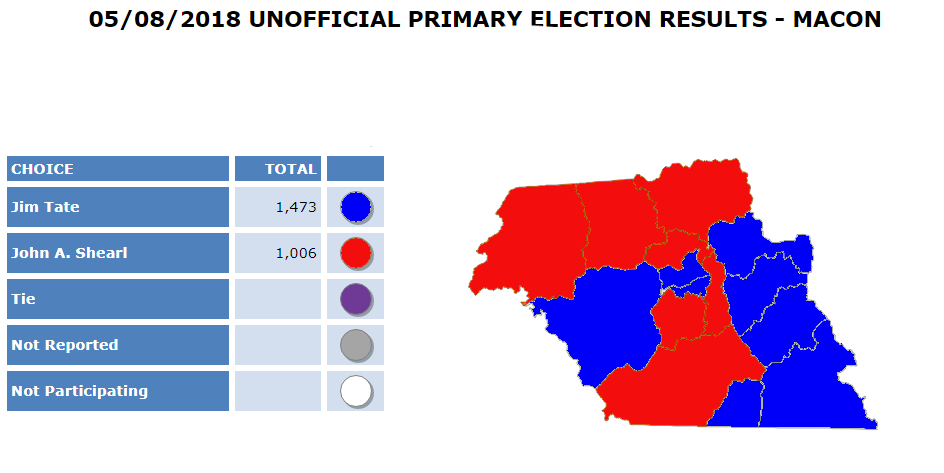
Incumbents Congressman Mark Meadows and County Commissioner Jim Tate won primaries yesterday. Mark Meadows will be facing Phillip G Price, who won the Democratic primary. Tate has no Democratic challenger this fall so he will be county commissioner for another four years. An article with a more detailed look at the primary results will be published later today.

LOCAL GOVERNMENT MEETINGS


Due to the rally and the primary, video of the meetings of the Franklin Town Council and Macon County Board of Commissioners will not be available until later this week. Macon Media apologies for the later than usual publication of these videos.


LOCAL OUTLOOK

Scattered showers and thunderstorm chances will continue today and tomorrow on the upslope side of weak high pressure which will keep temperatures near normal through mid-week. Greater precipitation chances will arrive for Thursday with an approaching front and scattered daytime showers and thunderstorms are possible through the weekend as temperatures warm to well-above normal.


WEATHER SPONSOR


Adams Products, a Division of Oldcastle is underwriting the daily weather briefing & public safety updates for the month.

Open 7:30 AM to 4:00 PM, M-F, located at 895 Hickory Knoll Road, Franklin, NC. Visit our Facebook page at:
https://www.facebook.com/Adams.Oldcastle.Franklin.NC/

All your masonry needs are available. Our phone number is 828.524.8545, the public is welcome, we’ll help you  with your with your next project.

Weather Almanac for May 9th (1872-2016)

Record weather events for this date in Macon County

Highest Temperature 89°F in Franklin in 1962
Lowest Temperature 28°F at the Coweeta Experimental Station in 1947
Greatest Rainfall 1.46 inches in Highlands in 1969
Greatest One-Day Snowfall 2.5 inches in Highlands in 1992

Record Weather Events for May (1872-2017)

Highest Temperature 92°F at the Coweeta Experimental Station on May 20, 1996
Lowest Temperature 23°F at the Coweeta Experimental Station on May 2, 1963
Greatest Rainfall 4.2 inches in Highlands on May 23, 1923
Greatest One-Day Snowfall 2.5 inches in Highlands on May 7, 1992


THREE DAY OUTLOOK

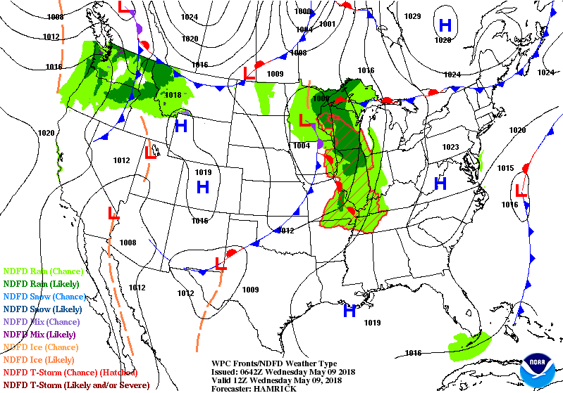
The images below represent the daily forecast at 8 am for today, tomorrow and the day after tomorrow. Click on any of them to enlarge.


----------------------------------
FRANKLIN AREA

TODAY

A 20 percent chance of showers after 2pm. Mostly sunny, with a high near 78. Calm wind becoming south southwest around 6 mph in the afternoon.

TONIGHT

Partly cloudy, with a low around 54. Calm wind.

THURSDAY

A slight chance of showers, then a chance of showers and thunderstorms after 10am. Partly sunny, with a high near 82. Light west southwest wind becoming west 5 to 10 mph in the morning. Chance of precipitation is 50%. New rainfall amounts of less than a tenth of an inch, except higher amounts possible in thunderstorms.

THURSDAY NIGHT

A 20 percent chance of showers and thunderstorms before 11pm. Partly cloudy, with a low around 55. West wind around 5 mph becoming calm in the evening.

FRIDAY

A 30 percent chance of showers and thunderstorms, mainly after 4pm. Mostly sunny, with a high near 85.

FRIDAY NIGHT

A 30 percent chance of showers and thunderstorms before 7pm. Partly cloudy, with a low around 58.

-----------------------------------------
OTTO AREA

TODAY

A 20 percent chance of showers after 2pm. Mostly sunny, with a high near 78. Calm wind becoming south around 6 mph in the afternoon.

TONIGHT

A 20 percent chance of showers before 10pm. Partly cloudy, with a low around 54. Light south wind.

THURSDAY

A slight chance of showers, then a chance of showers and thunderstorms after 10am. Mostly sunny, with a high near 82. Light west wind increasing to 5 to 10 mph in the morning. Chance of precipitation is 50%. New rainfall amounts of less than a tenth of an inch, except higher amounts possible in thunderstorms.

THURSDAY NIGHT

A 20 percent chance of showers and thunderstorms before 11pm. Partly cloudy, with a low around 56. West wind around 5 mph becoming calm in the evening.

FRIDAY

A 30 percent chance of showers and thunderstorms, mainly after 3pm. Mostly sunny, with a high near 85.

FRIDAY NIGHT

A 30 percent chance of showers and thunderstorms before 8pm. Partly cloudy, with a low around 58.

---------------------------------------------
HIGHLANDS AREA

TODAY

A slight chance of showers between 1pm and 3pm, then a slight chance of showers and thunderstorms after 3pm. Mostly sunny, with a high near 69. Light and variable wind becoming south southwest 5 to 10 mph in the morning. Chance of precipitation is 20%.

TONIGHT

A slight chance of showers and thunderstorms before 7pm, then a slight chance of showers between 7pm and 11pm. Partly cloudy, with a low around 54. West southwest wind 3 to 7 mph. Chance of precipitation is 20%.

THURSDAY

A slight chance of showers, then a chance of showers and thunderstorms after 10am. Mostly sunny, with a high near 72. West wind 8 to 11 mph, with gusts as high as 20 mph. Chance of precipitation is 50%. New rainfall amounts of less than a tenth of an inch, except higher amounts possible in thunderstorms.

THURSDAY NIGHT

A 20 percent chance of showers and thunderstorms before 11pm. Partly cloudy, with a low around 56. West wind around 8 mph.

FRIDAY

A slight chance of showers, then a chance of showers and thunderstorms after 9am. Mostly sunny, with a high near 74. Chance of precipitation is 40%.

FRIDAY NIGHT

Partly cloudy, with a low around 58.

--------------------------------------------
NANTAHALA AREA

TODAY

A 20 percent chance of showers after 2pm. Mostly sunny, with a high near 74. Light and variable wind becoming south southwest 5 to 8 mph in the morning.

TONIGHT

Partly cloudy, with a low around 56. South wind around 5 mph.

THURSDAY

A slight chance of showers, then a chance of showers and thunderstorms after 10am. Partly sunny, with a high near 76. West wind 5 to 13 mph, with gusts as high as 22 mph. Chance of precipitation is 50%. New rainfall amounts of less than a tenth of an inch, except higher amounts possible in thunderstorms.

THURSDAY NIGHT

A slight chance of showers and thunderstorms before 11pm, then a slight chance of showers between 11pm and midnight. Partly cloudy, with a low around 56. West wind 3 to 7 mph. Chance of precipitation is 20%.

FRIDAY

A 30 percent chance of showers and thunderstorms, mainly between 11am and 1pm. Mostly sunny, with a high near 78.

FRIDAY NIGHT

Partly cloudy, with a low around 59.

----------------------------------------


GOES-16 GeoColor - True Color daytime, multispectral IR
12:47 am to 3:42 am this morning


HAZARDS

Hazardous weather is not expected today.

Macon Media maintains a Severe Weather Preparedness Page at http://thunderpigblog.blogspot.com/p/breaking-news-hub.html for those who are interested.

As always, you can check to see what advisories, watches, and warnings are in effect for Macon County by visiting http://is.gd/MACONWARN


GOES 16 - Band 15 - 12.3 µm - Dirty Longwave Window - IR (Precipitation)
3:42 am this morning


MACON CALENDAR

If you have an event you wish to be added to this calendar, please send the information, along with a flyer in pdf format or a high-quality photo, to editor@maconmedia.com. If you want text published, please include a paragraph with your photo, flyer or graphics. Please include date(s) and time(s).
There is no charge for civic, educational or nonprofit groups, except for groups or events that receive funding from the TDA, TDC, and EDC, where full rates apply.


TRIMONT CHRISTIAN ACADEMY COMMUNITY YARDSALE

Want to sell all those extra items collecting dust around your house?

Join the indoor community yard sale at Trimont Christian Academy. Trimont will be doing community-wide advertising for this event.


OPERATION CHRISTMAS CHILD

I am writing to thank the residents of Franklin, Highlands, and Macon County for spreading joy to children around the world this Christmas. Through the generosity of the Macon County community, 4,636 shoeboxes were collected; and the Western North Carolina Area Team was able to exceed our goal by collecting 20,038 shoebox gifts for Operation Christmas Child, the world’s largest Christmas project of its kind. The International total for 2017 was 11,012,840 shoeboxes!

As National Volunteer Week (April 15 – 21) approaches, I wanted to pass along information about an opportunity for Macon County residents to join a local volunteer team with Operation Christmas Child. This project of the international Christian relief organization, Samaritan’s Purse, sends gift-filled shoeboxes to millions of children in need each year and gives local residents the opportunity to make a worldwide impact. “National Volunteer Week is a great time to become a part of this international project,” said June Trull, who heads up the Western North Carolina Area Team of Operation Christmas Child.“Joining an Operation Christmas Child Area Team is an amazing way to give back year-round and share God’s love with children in need.”


Operation Christmas Child has delivered more than 157 million gift-filled shoeboxes to children in more than 160 countries since 1993. This year, the local Western North Carolina Area Team hopes to collect 21,000 shoebox gifts to contribute to the 2018 global goal of reaching more than 11 million children in need.

Operation Christmas Child is a project of Samaritan’s Purse, an international Christian relief and evangelism organization headed by Franklin Graham. The mission of Operation Christmas Child is to demonstrate God’s love in a tangible way to children in need around the world, and together with the local church worldwide, to share the Good News of Jesus Christ.

Thank You
Brenda Hackett
Samaritan's Purse
Media Support
Western North Carolina Area Team
Operation Christmas Child
828-369-6674/ bjandhack@hotmail.com
samaritanspurse.org/occnewsroom


Uptown Gallery classes
(These are on-going classes – repeat weekly)

Free classes and open studio times are being offered at The Uptown Gallery in Franklin. Join others at a painting open studio session every Tuesday from 6:30 pm – 9:00 pm or on Thursday from 11:00 am – 3:00 pm.
Bring your own materials and join an on-going drawing course led by gallery artists on Fridays, from 11am – 2 pm. For information on days open, hours and additional art classes and workshops, contact the gallery on 30 East Main Street at (828) 349 – 4607.


National Alliance on Mental Illness
Appalachian South


Meets each Thursday at 7pm
The First Methodist Church Outreach Center
at the intersection of Harrison Ave. and West Main Street
(directly across from Lazy Hiker Brewery)

Come join our weekly support group for anyone suffering from mental illness and their family or friends. This includes Depression, Bipolar,8chizophrenia, PTSD, Substance Abuse, Etc.

Here you will find:
— others living with mental health challenges YOU ARE NOT ALONE
- learn coping skills and ?find hope in shared experience
- help learning how to break down stigma and guilt surrounding mental health
- how to live life with the expectation of a better a better future

Kay (706)970-9987 Denise (828)347-5000)

SYRINGE EXCHANGE PROGRAM

On January 1, 2017, the Syringe Exchange Program of Franklin began operating a comprehensive harm reduction program to address the opioid epidemic that is impacting western NC. Opioid overdose reversal kits including naloxone are available free of charge. If you have any questions about our services or if you know someone interested in volunteering, please contact Stephanie Almeida at 828-475-1920.


Sun and Moon

Sun

Begin civil twilight 6:07 a.m.
Sunrise 6:35 a.m.
Sun transit 1:30 p.m.
Sunset 8:26 p.m.
End civil twilight 8:54 p.m.


Moon

Moonrise 3:21 a.m.
Moon transit 8:55 a.m.
Moonset 2:34 p.m.


Phase of the Moon on May 9, 2018: Waning Crescent with 35% of the Moon's visible disk illuminated.
Closest Primary Moon Phase: Last Quarter on May 7, 2018 at 10:09 p.m. (local daylight time)

Sky Guides for this week


Sky and Telescope Magazine 
Astronomy Magazine


There will be three solar and two lunar eclipses in 2018. [LINK]

Heavens Above has an Android App that will assist you in observing the sky and even has a satellite tracker that will let you know when the International Space Station and dozens of other satellites are overhead. [LINK]

Stellarium is also an app that will assist you in observing the sky. It is available in both Android [LINK] and iOS versions. [LINK]

CROWDFUNDING OR DAY SPONSORSHIP OPPORTUNITIES

If you receive value from what Macon Media provides to the community, please consider becoming a supporter and contribute at least a dollar a month.

If you have a business or event you are interested in sponsorship opportunities or underwriting coverage, send an email to editor@MaconMedia.com for more information. Serious inquiries only. Macon Media rewards early sponsors/underwriters with lifetime guaranteed low rates while newer sponsors/underwriters pay higher rates based on the date they first support Macon Media.

Thank You to the people who have been sending in donations and those businesses who are underwriting coverage of news and events. You have kept Macon Media online. You have made it possible for Macon Media to begin purchasing state of the art equipment and begin work on building a real website with features not employed by any local news outlets.

You can find out more information on how to do that and some of what I plan to accomplish if I reach certain levels of funding at https://www.patreon.com/MaconMedia

Published at 4:10 am on May 9, 2018

#WNCscan #MaconWx #MaconSafety

Data and information sources: Sources (except where otherwise credited): heavens-above.com, Ian Webster's Github, National Centers for Environmental Prediction, The National Weather Service, National Oceanic Atmospheric Administration, Penn State University Electronic Wall Map, The State Climate Office of North Carolina, Storm Prediction Center, U.S. Naval Observatory, and the Weather Prediction Center.

Tuesday, May 8, 2018

Rally in Support of Scott Knibbs
May 8, 2018


A Rally for Scott Knibbs was held at Speaker's Corner beside the Macon County Courthouse at noon today. Mark Melrose, the attorney for the Knibbs family, addressed a crowd of family, friends, and supporters of the Knibbs family. He spoke of concerns in the handling of the of the incident by Deputy Momphard and Sheriff Robert Holland and repeated a request he made earlier to the District Attorney for her, due to her close relationship with the Sheriff, to recuse herself from this case. A number of friends and Scott's father also spoke, reminding those gathered of Scott's character and contributions to his family, the community, and his church. During the rally, a couple of long sustained horn blasts were heard by people attempting to disrupt the rally and one woman yelled from her car at the crowd, “ya’ll need to just go home.”

A video of the entire rally is posted below in order that a complete and accurate record of the event is relayed to the public.


Here are some photos that were taken at the rally this afternoon:
[click on any of them to enlarge]


Media outlets represented at the rally include WLOS-TV (reporter and camera operator), Fox Carolina (reporter and camera operator), Macon Media (reporter), Macon County News and Shopping Guide (photographer) and The Franklin Press (reporter).

DAY SPONSOR

John Shearl for County Commissioner is underwriting the daily weather briefing and public safety updates for today.

My name is John Shearl, and I am a candidate for Macon County Commissioner District 1. I stand for strong fiscal management, transparent government,
and most importantly, private property rights without government intrusion.

Learn more at https://JohnShearl.com


CROWDFUNDING OR DAY SPONSORSHIP OPPORTUNITIES

If you receive value from what Macon Media provides to the community, please consider becoming a supporter and contribute at least a dollar a month.

If you have a business or event you are interested in sponsorship opportunities or underwriting coverage, send an email to editor@MaconMedia.com for more information. Serious inquiries only. Macon Media rewards early sponsors/underwriters with lifetime guaranteed low rates while newer sponsors/underwriters pay higher rates based on the date they first support Macon Media.

Thank You to the people who have been sending in donations and those businesses who are underwriting coverage of news and events. You have kept Macon Media online. You have made it possible for Macon Media to begin purchasing state of the art equipment and begin work on building a real website with features not employed by any local news outlets.

You can find out more information on how to do that and some of what I plan to accomplish if I reach certain levels of funding at https://www.patreon.com/MaconMedia


Published at 3:15 pm on May 8, 2018