Discover PostGIS: Add Spatial functions to PostgreSQL
1 like262 views

PostGIS is an open-source, freely available spatial database extension for the PostgreSQL Database Management System. PostGIS adds spatial functions such as distance, area, union, intersection, and specialty geometry data types to PostgreSQL. Take a look at these slides to learn more about spatial data types, multidimensional spatial indexing, and spatial functions.


![[공간정보연구원] 1일차 - QGIS 개요 및 기초](https://cdn.slidesharecdn.com/ss_thumbnails/day102qgis-140805015828-phpapp02-thumbnail.jpg?width=560&fit=bounds)


More Related Content
What's hot (20)
Similar to Discover PostGIS: Add Spatial functions to PostgreSQL (20)


More from EDB (20)


Recently uploaded (20)


Discover PostGIS: Add Spatial functions to PostgreSQL
- 1. © 2018 EnterpriseDB® Corporation. All rights reserved. 1 DISCOVER POSTGIS 1 Mansur Shaikh CONFIDENTIAL © Copyright EnterpriseDB Corporation, 2019. All rights reserved.
- 2. CONFIDENTIAL © Copyright EnterpriseDB Corporation, 2018. All rights reserved. THE DATABASE PLATFORM COMPANY FOR DIGITAL BUSINESS EnterpriseDB (EDB) delivers the premier open source-based, multi-model data platform for new applications, cloud re-platforming, application modernization, and legacy migration. 2
- 3. © Copyright EnterpriseDB Corporation, 2018. All rights reserved. Who is EDB?
- 4. © Copyright EnterpriseDB Corporation, 2018. All rights reserved. WHO IS EDB? Founded in 2004 Customer base > 4000 500+ employees in offices worldwide Recognized RDBMS leader Gartner Forrester Largest PostgreSQL community leader: • EDB Postgres Technology Platform • Services, Training & RDBA • Community PostgreSQL Experts • Community contributions and influence • Partner ecosystem The world leader in open-source based Postgres software and services.
- 5. © 2018 EnterpriseDB® Corporation. All rights reserved. 5 CONFIDENTIAL © Copyright EnterpriseDB Corporation, 2019. All rights reserved. 5 Customers working SMARTER, reducing RISK and being more PRODUCTIVE with EDB. OVER 4,000 CUSTOMERS U.S Customers EMEA Customers APAC Customers 102 of the Fortune 500 337 of the Forbes Global 2000
- 6. WORLDWIDE PRESENCE CONFIDENTIAL © Copyright EnterpriseDB Corporation, 2019. All rights reserved.6
- 7. CONFIDENTIAL © Copyright EnterpriseDB Corporation, 2018. All rights reserved. ONLY OPEN SOURCE RDBMS IN GARTNER MQ EDB Recognized 7 Years In A Row on Gartner’s Magic Quadrant
- 8. © 2015 EnterpriseDB Corporation. All rights reserved. 8 Getting started with PostGIS
- 9. © 2018 EnterpriseDB® Corporation. All rights reserved. 9 About PostGIS • Refractions Research released first version in 2001 under the GNU license • Follows the Simple Features for SQL specification from the Open Geospatial Consortium (OGC) • Over 300 spatial operators and spatial functions − Processing and analytical functions • Spatial data types • Spatial indexing • Spatial reprojection • Import / Export shapefiles (command line and GUI) • Commands for importing raster data • SQL commands to render and import data from multiple formats such GeoJSON, KML, GML, and WTK 9
- 10. © 2018 EnterpriseDB® Corporation. All rights reserved. 10 PostGIS : Getting started with spatial databases • QGIS − Open Source desktop GIS • Enterprise GIS − An integrated GIS system that is accessible throughout your organization • Spatial database − A centralized location for storing spatial data − Spatial features for dealing with spatial data and analysis • PostGIS − A specific implementation of a spatial database built on the PostgreSQl database
- 11. © 2018 EnterpriseDB® Corporation. All rights reserved. 11 PostGIS Data Types Geometry Geography Raster Topology
- 12. © 2018 EnterpriseDB® Corporation. All rights reserved. 12 PostGIS Data subtypes Point Linestring Polygon Multipoint Multilinestring Multipolygon
- 13. © 2018 EnterpriseDB® Corporation. All rights reserved. 13 Spatial Definitions Examples (1 of 5) Boundary
- 14. © 2018 EnterpriseDB® Corporation. All rights reserved. 14 Spatial Definitions Examples (2 of 5)
- 15. © 2018 EnterpriseDB® Corporation. All rights reserved. 15 Spatial Definitions Examples (3 of 5)
- 16. © 2018 EnterpriseDB® Corporation. All rights reserved. 16 Spatial Definitions Examples (4 of 5) Equals
- 17. © 2018 EnterpriseDB® Corporation. All rights reserved. 17 Getting started (loading data…) 17 INSERT into events_geo(eventname,geom,date) SELECT eventname, st_setsrid(st_makepoint(lon,lat),4326) as geom,date FROM events; Events Table eventname character varying lat double precision lon double precision Date timestamp with time zone events_geo Table eventname character varying lat double precision Lon double precision Date timestamp with time zone
- 18. © 2018 EnterpriseDB® Corporation. All rights reserved. 18 Getting started (visual inspection) 18
- 19. © 2018 EnterpriseDB® Corporation. All rights reserved. 19 Getting started (visual inspection) 19
- 20. © 2018 EnterpriseDB® Corporation. All rights reserved. 20 Getting started (Geometry Input and Output) 20 Example Input function Insert into cities (name,state,geom) Values (‘Bedford’,’MA’, ST_GeomFromText(‘POINT(-71.248063 42.510547)’,4326));
- 21. © 2018 EnterpriseDB® Corporation. All rights reserved. 21 Getting started (Power of GIS & SQL) Create a route from a collection of waypoints captured in sequence Write a function to tell whether a given lat/lon pair is within a Point-Radius ring
- 22. © 2018 EnterpriseDB® Corporation. All rights reserved. 22 Getting started (Power of GIS & SQL) 34, 9 70, 12 Simple distance query between two points SELECT ST_Distance (ST_GeomFromText('POINT(34 9)’,4629), ST_GeomFromText('POINT(70 12)’,4629));
- 23. © 2018 EnterpriseDB® Corporation. All rights reserved. 23 Getting started (Power of GIS & SQL) Create a route from a collection of waypoints captured in sequence Write a function to tell whether a given lat/lon pair is within a Point-Radius ring
- 24. © 2018 EnterpriseDB® Corporation. All rights reserved. 24 Getting started (Power of GIS & SQL) All the powerful tools of the RDBMS are available to you Insert into cities (name,state,geom) Values (‘Bedford’,’MA’, ST_GeomFromText(‘POINT(-71.248063 42.510547)’,4326));
- 25. © 2018 EnterpriseDB® Corporation. All rights reserved. 25 Getting started (Power of GIS & SQL) Answer powerful questions with a simple query Example Input function Insert into cities (name,state,geom) Values (‘Bedford’,’MA’, ST_GeomFromText(‘POINT(-71.248063 42.510547)’,4326));
- 26. © 2018 EnterpriseDB® Corporation. All rights reserved. 26 Getting started (Power of GIS & SQL)
- 27. © 2018 EnterpriseDB® Corporation. All rights reserved. 27 What exactly is a spatial database ? • Simple features standard (SFS) developed by Open Geospatial Consortium − Storage − Geometry-BLOB Field − Spatial functions (buffer, intersect, etc) − PostGIS- ST_buffer(geom,400) − SQL Server-geom.STBuffer(400) − SQL/MM Spatial-extends SFS • Spatial Indexes
- 28. © 2018 EnterpriseDB® Corporation. All rights reserved. 28 Simple SQL Statement • Select nest_id, recentstat, ST_Distance(geom, home) from raptor_nests • Where recentspec=‘RTHA’ • Order by recentstat, nest_id; • Why use SQl – Standard, Text based, store in database, backups in plain text format, sent from web pages
- 29. © 2015 EnterpriseDB Corporation. All rights reserved. 29 PostGIS Installation
- 30. © 2018 EnterpriseDB® Corporation. All rights reserved. 30 Installing PostGIS on your Local Computer https://www.enterprisedb.com/downloads/postgis
- 31. © 2018 EnterpriseDB® Corporation. All rights reserved. 31 PgAdmin4 Open PgAdmin4 Select on server and create server Right click on database and create database -> sdb_course Select sdb_course-> verify extensions and schemas and functions Add PostGIS extension Select sdb_course Open query tool-> create extension postgis; Verify functions, extensions and public schema spatial_ref_sys
- 32. © 2018 EnterpriseDB® Corporation. All rights reserved. 32 Installing QGIS : DEMO • Download link https://qgis.org/en/site/forusers/download.html
- 33. © 2018 EnterpriseDB® Corporation. All rights reserved. 33 Loading Spatial data into PostGIS − Resource file :- sdb_data.zip − Loading shapefile − Using PostGIS shapefile and dbf exporter − Command line :- c:programefilespostgresql11bin − raster2pgsql , shp2pgsql − Open Postgres shapefile import/export manager − View connection detail-> import->add file − Goto S DB_DATA folder -> load baea-nests.shp and bowl_habitat.shp − Give special reference id is 4326
- 34. © 2018 EnterpriseDB® Corporation. All rights reserved. 34 Loading Spatial data into PostGIS using QGIS • Load into QGIS and then put into PostGIS − Any type of vector data you can load and view – ESRIGeo, or Jeojson, GPS file − Select SDB_DATA folder from browser panel and drag and paste layers panel − Select three file GBH_Rookeries.shp, Linear_Projects.shp, Raptor_Nests-shp − First make connection − Select database-> Dbmanager -> − Make a connection with postgis from Browser panel -> provide connection information − Click on basic for authentication and click on store -> Test connection − List tables with no geometry − Click on ok − Click on import − Give input file GBH_Rookeries, Linear_projects, Raptor_nests one by one Go to PGAdmin4 and verify sdb_course with these five tables
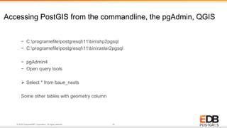
- 35. © 2018 EnterpriseDB® Corporation. All rights reserved. 35 Accessing PostGIS from the commandline, the pgAdmin, QGIS − C:programefilepostgresql11binshp2pgsql − C:programefilepostgresql11binraster2pgsql − pgAdmin4 − Open query tools Select * from baue_nests Some other tables with geometry column
- 36. © 2018 EnterpriseDB® Corporation. All rights reserved. 36 4. Making SQL Spatial • The PostGIS Vector Geometry model • The Spatial reference ID • The Geometry field • Geometry vs Geography data type • Spatial queries-working with Geometries • Spatial queries-Measurement • Spatial queries – Accessing the geometry
- 37. © 2018 EnterpriseDB® Corporation. All rights reserved. 37 4. Vector Geometry Model • Conforms to the OGC SFS standard • Basic data structure is a Point − 2 dimension –X and Y values. (longitude and latitude), projection − 3 Dimension value- z values • Line String is an array of points • Polygon is an array of closed LineString’s − First Linestring is an exterior ring − Each following LineString is an interior ring
- 38. © 2018 EnterpriseDB® Corporation. All rights reserved. 38 4. Vector Geometry Model. Cont.. • Multi-Part geometries − Array of individual geometries − Multipoint − MultiLinestring − MultiPolygon • Features − Geometry − Attributes(field, properties,etc)
- 39. © 2018 EnterpriseDB® Corporation. All rights reserved. 39 Spatial Reference ID • Unique identifier for a coordinate reference system − Coordinate System :- based in angles based on earth − Projection − Zone − Datum • In PostGIS you indicate the Spatial Reference by a number • That number corresponds to well known Text • Individual Geometries can have a spatial reference • Geometry columns have a spatial reference
- 40. © 2018 EnterpriseDB® Corporation. All rights reserved. 40 The Geometry field • The geometry field is what makes a table spatial • Its just a column in the database that can store a feature geometry • It includes the SRID, the geometry type, and the actual coordinates in binary form • We can’t interpret the binary data but PostGIS provides a number of functions that can output the geometry in human readable format binary data could be picture, shape any things These are functions that can output geometry as human redable text • ST_AsText(), ST_AsEWKT(), ST_AsGeoJSON, etc. • The combination of a geometry and the attribute that describes that geometry is known as features
- 41. © 2018 EnterpriseDB® Corporation. All rights reserved. 41 Geometry vs Geography • Two different ways to store a features spatial information − Geometry (data type). Based on plain surface − Geography. (data type). Based on circular earth , math behind calculation is complicated • Geometry − Based on planner surface − Can be in a variety of coordinates reference systems defined by OGC − Are mathematically simple − Rich set of functions available − OGC standard , GEOS libraries, etc. − Accuracy declines as spatial extent increases.
- 42. © 2018 EnterpriseDB® Corporation. All rights reserved. 42 Geometry vs Geography cont .. • Geography − Based on round earth − Can only be in geographic coordinates system (latitude/longitude) − Are mathematically complex − Only support a fraction of the functions that are available for geometries − Accurate measurements − Which should you use ?? − Scale of your data and if larger distance use geography − Availability of functions that you need − performance
- 43. © 2018 EnterpriseDB® Corporation. All rights reserved. 43 Working with Geometries • What can we do with Geometries in PostGIS − Get information about it − GeometryType(geom) what type point, line or polygon − ST_CoordDIM(geom). How many coordinate associate with each points − ST_Dimension(geom). Like if line then it is one dimenstional, polygon is area which is two dimensional − ST_SRID(geom). :- special reference id for geometry − ST_IsCollection(geom) :- returns true if geometry is single point or multipoint polygon − ST_NumGeometries(geom),ST_NuminteriorRings(geom),ST_NumPoints(geom) − ST_IsSimple(geom),ST_IsEmpty(geom),ST_IsClosed(geom),ST_isRing(geom) − ST_IsValid(geom), ST_IsValidReason(geom) • Change it’s spatial reference • ST_SetSRID(geom,SRID) changes special reference id associated with that geometry • ST_Transform(geom,SRID) converts one coordinate reference system to another
- 44. © 2018 EnterpriseDB® Corporation. All rights reserved. 44 Spatial Queries :- Measurements • What we can do with geometry ? − Measure it − ST_Length(line) − Geometry- Cartesian length in SRID units − Geography-length in meters over the spheroid − ST_3DLength(line) - Geometry-3D cartesian length using SRID - Geography - Not supported − ST_LengthSpheroid(line, spheroid) − ST_Area(polygon) − Geometry- cartesian area in SRID units − Geography-area in square meters over the spheroid − ST_Perimeter(polygon), ST_3DPerimeter(polygon)
- 45. © 2018 EnterpriseDB® Corporation. All rights reserved. 45 Spatial Queries :- Accessing the Geometries • What we can do with geometry ? − Calculate distance from other geometries − ST_Distance(geom1,geom2) Geometry-cartesian distance in SRID units Geography – length in meters over the spheroid − ST_3DDistance(geom1,geom2) - Geometry- cartesian distance using SRID in units - Geography - Not supported ST_DistanceSphere(geom1,geom2) Geometry-cartesian area in SRID units squre degrees Geography:- area in squre meters over the spheroid ST_Perimeter(polygon), ST3DPerimeter(polygon)
- 46. © 2018 EnterpriseDB® Corporation. All rights reserved. 46 Spatial Queries :- Accessing the Geometries • What we can do with geometry ? − Calculate distance from other geometries − See it’s coordinate in text form − ST_AsText(geom), ST_AsWKT(geom) − ST_AsGeoJSON(geom) − ST_AsGML(geom), ST_AsKML(geom) − ST_AsMVT(table) − Access it’s Coordinates - ST_X(point), ST_Y(point), ST_Z(point), ST_M(point) - ST_StartPoint(geom0, ST_EndPoint(geom) − ST_PointN(geom,n), ST_LineinterpolatePoint(geom,proportion) − ST_GeometryN(geom,n) − ST_ExteriorRing(geom), ST_interiorRingN(geom,n)
- 47. © 2018 EnterpriseDB® Corporation. All rights reserved. 47 • Docs - http://www.postgis.org/docs/ • PostGIS in Action, 2nd Edition − http://www.amazon.com/gp/search?index=books&linkCode=qs&keywords=9781617291395 Resources:
- 48. © 2018 EnterpriseDB® Corporation. All rights reserved. 48 48 Postgres Vision Goes Virtual in 2020. APJ Track on 24th June Time: 8.30am – 11.45am IST/ 11.00am – 2.45pm Singapore/1.00pm to 4.45pm AU EST Attend from the comfort of your home. Learn: • how organizations are using PostgreSQL to reduce cost & increase innovation • the tools and technology that PostgreSQL experts are using • how developers are using PostgreSQL databases • about the of future of PostgreSQL and much more REGISTER NOW
- 49. © 2018 EnterpriseDB® Corporation. All rights reserved. 49 THANK YOU [email protected] www.enterprisedb.com CONFIDENTIAL © Copyright EnterpriseDB