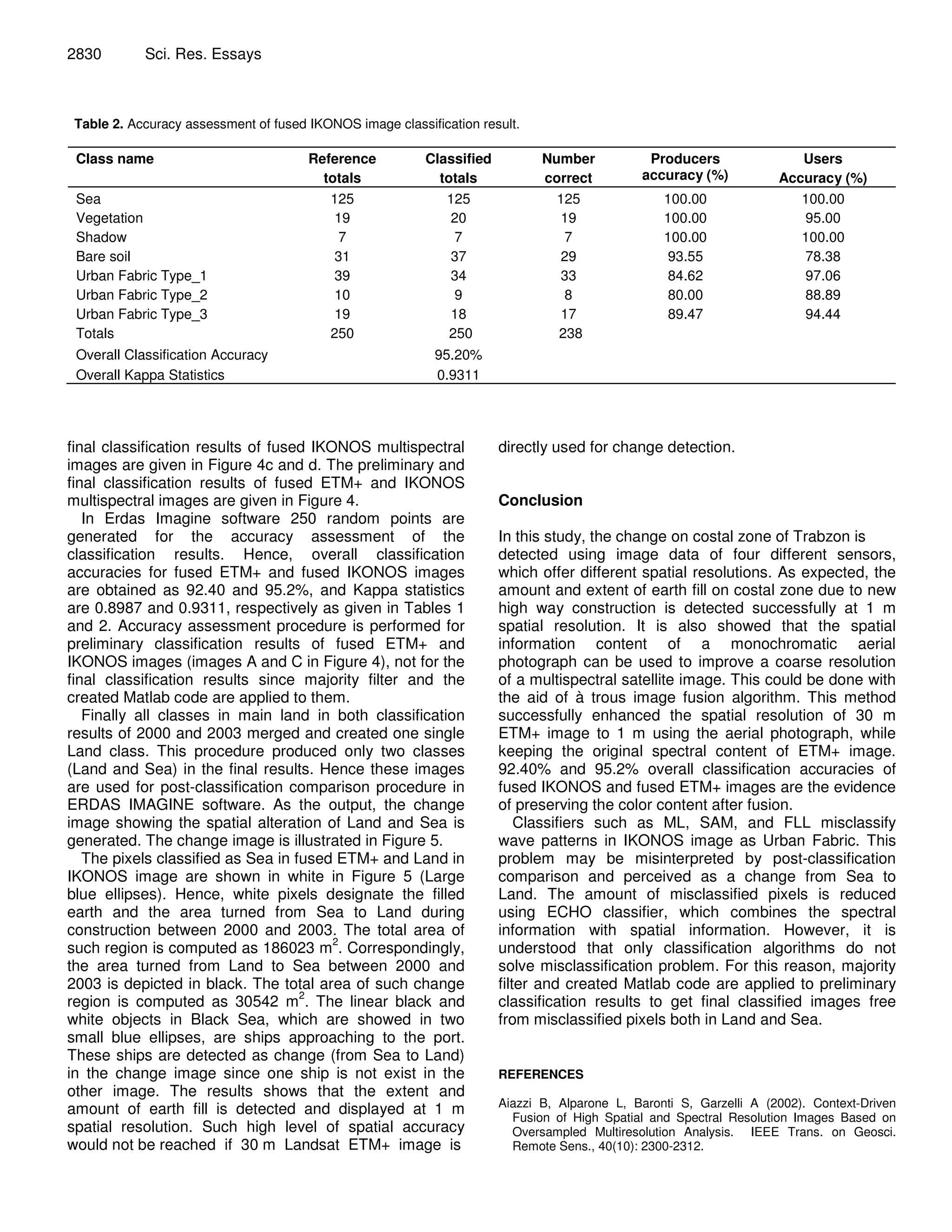
This document summarizes a study that used multi-sensor data fusion to detect changes in a coastal zone in Trabzon, Turkey between 2000 and 2003. The study fused higher resolution aerial photographs and IKONOS panchromatic data with lower resolution ETM+ multispectral data to create 1m resolution multi-spectral images for both time periods. Post-classification comparison of the fused images from 2000 and 2003 was then used to detect changes in the coastal zone due to highway construction, identifying an area of 186023 m2 of new filled earth. Fusion was performed using the à trous wavelet transform algorithm to preserve spectral content while improving spatial resolution for accurate change detection.


![Earth Science and Remote Sensing Applications [Book]](https://cdn.slidesharecdn.com/ss_thumbnails/earthscienceandremotesensingapplicationsvol432018springer-180222222235-thumbnail.jpg?width=640&height=640&fit=bounds)


